City of South Pasadena On-Call GIS Services
Technology Guides a City's Growth
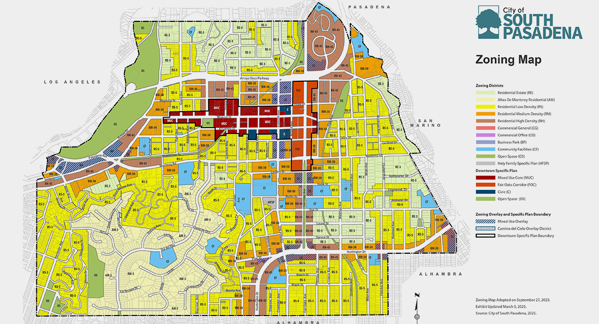
South Pasadena, known as the City of Trees, is a close-knit community with a small-town feel located just six miles from downtown Los Angeles. When the carefully preserved City needed assistance with Geographic Information Systems (GIS) services to support their evolving planning and land use priorities, MIG delivered innovative solutions:
- A redesigned citywide Zoning Map—to align with recent Zoning Code amendments and the City’s newly adopted Housing Element
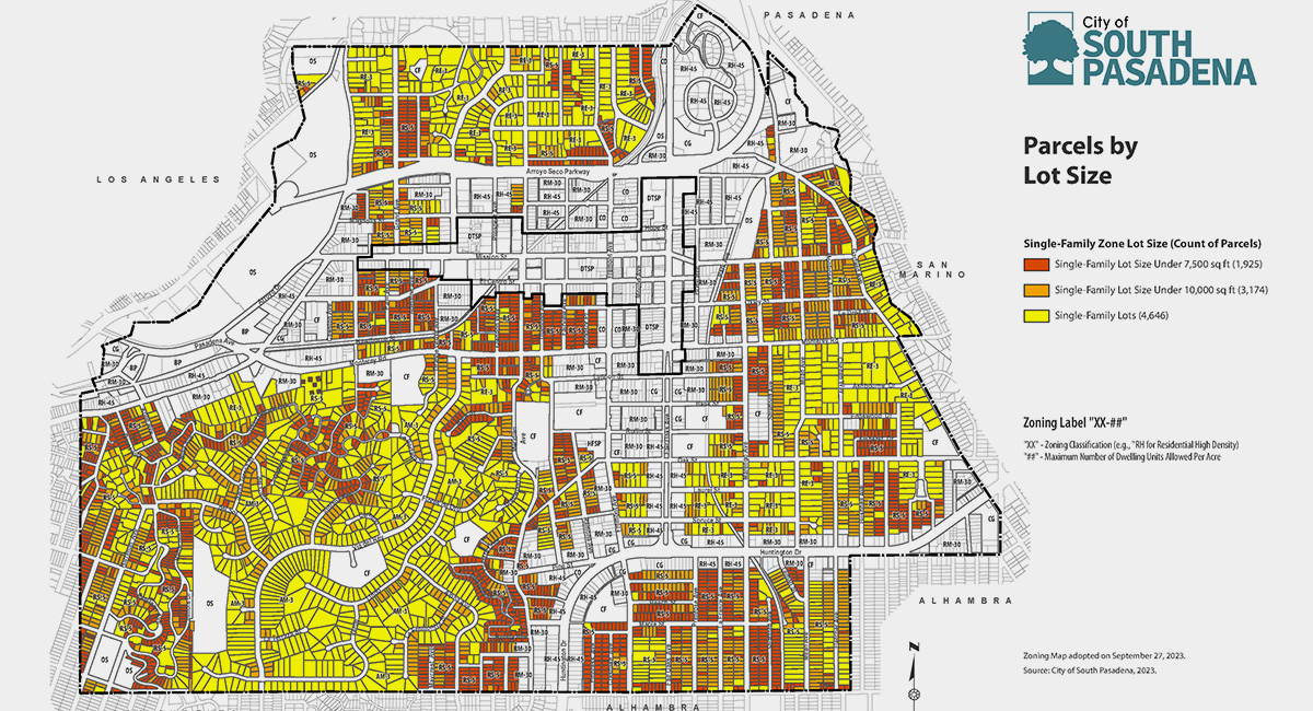
- A spatial analysis of the City’s Housing Element Sites Inventory with unit capacity and density range calculations—to meet State housing law requirements
- Density scenario maps illustrating alternative buildout patterns and housing estimates—to visualize potential changes and inform policy refinement
- A Public Notification Map and Table Generator with automated parcel identification within notification radii—to automate parcel identification within notification radii and compile mailing data for streamlined outreach
- A centralized and connected spatial database with current zoning, land use, housing, and environmental layers—to allow staff access to accurate and up-to-date information
- Rigorous data management and version control practices—to assure consistency across planning efforts and public communication tools
The team’s technical support spanned a variety of data needs—emphasizing accuracy, transparency, and ease of use while fully integrating with the City’s geodatabase and ArcGIS Online environment.